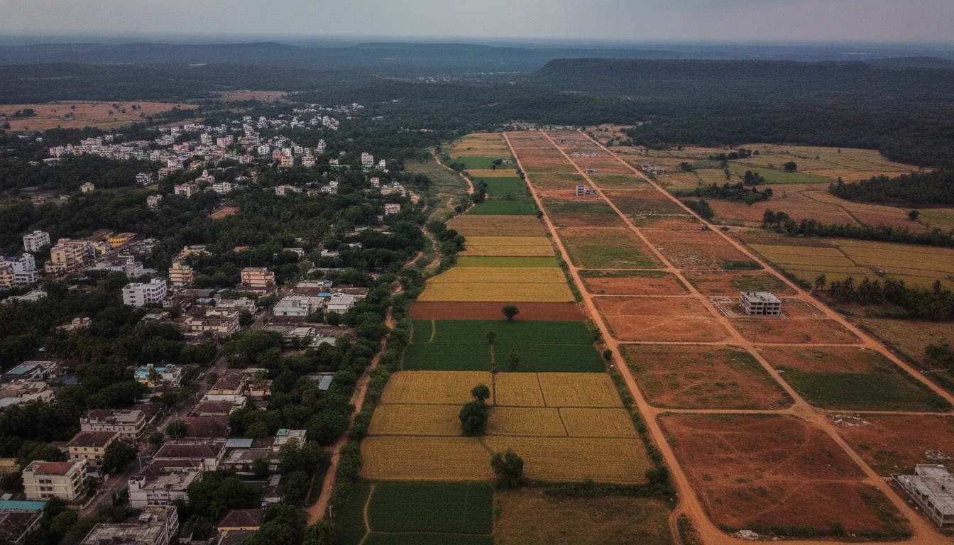
The best location for farmland near Bangalore depends on how you will use the land, measured against six things you can check: the drive, the water, the soil, the access road, the title pattern and the price pressure. Most location guides skip that step and go straight to a list of places, usually the places the writer sells in.
This guide compares eight corridors around Bengaluru against those six checks. Vibez Estates sells managed farmland in two of them. The other six are places we do not operate in, and they are covered with the same care, because a guide that only covers its publisher’s corridors is a catalogue. The short answer, by type of buyer, comes first.
Which corridor near Bangalore suits which buyer
The right corridor near Bangalore depends first on how often you will really go, and then on whether the water can carry what you plan to grow. For weekend visits, pick a corridor on your side of the city and test its groundwater before anything else. For a plantation crop and fewer, longer stays, look to the Western Ghats. “Best” on this page means best for how you will use the land, and every distance and water fact below carries its source and date.
-
You live in north or east Bengaluru and will visit most weekends: the north belts (Devanahalli, Doddaballapur, Chikkaballapur). Check water first: Bengaluru Rural and Chikkaballapur are among the districts reported as over-exploited for groundwater in the 2025 assessment.
-
You live in south Bengaluru: Kanakapura Road. The district’s groundwater is reported in the “critical” category, and the second-airport talk is still talk: two shortlisted sites are near Kanakapura Road and no site has been decided.
-
You are looking at Hosur and the border belt: that land is in Tamil Nadu, so Karnataka’s land rules and records do not apply.
-
You want a plantation crop and can accept fewer, longer visits: Sakleshpur in the Western Ghats, 220 km from Bangalore (Karnataka Tourism).
That verdict rests on six checks, and they are worth knowing before you look at any one place.
What decides whether a farmland corridor is right for you
A farmland corridor suits you or not on six things you can check: the drive, the water, the soil and rainfall, the access road, the title and conversion pattern, and the price pressure. Buyers get the first two wrong most often.
- The drive: Judge it from your own start point at the hour you would really leave, not from the map distance. The co-decider in most families settles this one, and the usual test is blunt: “We will go twice and never again.”
- Water: Check it at two levels. First the district’s groundwater category in the Central Ground Water Board’s 2025 assessment, then the plot’s own bore yield, tested in the dry months. Serious water checks cluster between February and May for that reason.
- Soil and rainfall: These decide what will grow without constant irrigation. The plains around Bengaluru sit in the Eastern Dry Zone, with about 823 mm of normal annual rainfall in Bengaluru South district.
- The access road: Drive it in the worst month. A road that works in March can be a different road in August, more so in the hills.
- The title and conversion pattern: This changes by corridor: which state’s law applies, whether the parcel sits in a planning area where any conversion engages the Town and Country Planning Act, and whether eco-zone or buffer rules may reach it.
- Price pressure: This is whatever pushes asking prices up. Split it into what has happened, such as a road that is open, and what is only announced. This page gives no price figures.
With the six checks set, the eight corridors can be measured against them.
How do the corridors around Bangalore compare, one by one
Eight corridors run out of Bengaluru by direction, from the airport belt in the north round to the Western Ghats in the west, and two of them are where Vibez Estates sells land. Each profile below says who the corridor suits, its strongest and weakest point, and what to check first. Every corridor has a drawback, including ours.
Managed farmland near Doddaballapur and Devanahalli (north airport belt)
This belt suits buyers in north Bengaluru who want to visit often. The airport is what pushes prices here. Bengaluru Rural district is among those reported over-exploited for groundwater, and the land sits in the Eastern Dry Zone. Check first: the plot’s summer bore yield and the master-plan zone of the parcel. We do not operate here.
Chikkaballapur and the Nandi Hills side (north plateau)
Chikkaballapur is “around 60 km from Bengaluru city” (Karnataka Tourism), on the Nandi Hills plateau. It suits buyers in the north of the city who want a short run out. Its weak point is water: Chikkaballapur district is reported over-exploited for groundwater, and the plateau is in the Eastern Dry Zone. Check first: the bore test and the irrigation set-up. We operate here: Vibez Sirivana is a completed estate on this side.
Managed farmland near Hoskote (east, towards Kolar)
The east suits buyers living in east Bengaluru. Kolar and Bengaluru Rural are both among the districts reported over-exploited for groundwater, and the belt is in the Eastern Dry Zone. Search interest is thin, which usually means fewer managed projects to compare. Check first: water, then the access road. We do not operate here.
Managed farmland near Kanakapura (south)
Kanakapura Road suits buyers in south Bengaluru. It sits in Bengaluru South district, renamed from Ramanagara on 05/23/2025. The district’s groundwater is reported in the “critical” category. It is Eastern Dry Zone land with about 823 mm of normal rainfall, mostly deep red clay soils, growing ragi, groundnut and mango. Two second-airport shortlist sites lie near Kanakapura Road and none has been decided. Check first: water, and that the district names on your papers agree. We do not operate here.
Managed farmland near Hosur (south-east, across the state line)
Hosur is “40 Kms from Bangalore” (Government of Tamil Nadu), and with Thalli and Denkanikottai it is often listed as a Bangalore farmland belt. It is in Tamil Nadu. Karnataka’s land laws, the RTC on Bhoomi and Kaveri registration do not apply there, and the Karnataka groundwater and zone data in this guide do not cover it. Check first: title, with a Tamil Nadu advocate. We do not operate here.
Managed farmland near Tumakuru (west, Nelamangala towards Kunigal)
The west suits buyers living in west Bengaluru. Tumakuru district’s groundwater is reported in the “critical” category, and only part of the district is in the Eastern Dry Zone. One second-airport shortlist site was on Kunigal Road near Nelamangala; later reports say it lost priority. Check first: water and the access road. We do not operate here.
Managed farmland near Mysuru (south-west, through Mandya)
This corridor draws more searches than any other in the set. Mysuru district spans the Southern Transition and Hilly zones, with 782.2 mm of normal rainfall and large canal-irrigated tracts: about 159,100 hectares irrigated against 182,200 hectares rainfed. Check first: whether a plot’s water comes from a canal or a bore. We do not operate here.
Sakleshpur (Western Ghats)
Sakleshpur is “220 kms away from Bangalore” and known for “coffee and spice plantations” (Karnataka Tourism). Hassan district’s normal rainfall is 1,031.2 mm, and Hethur hobli in Sakleshpur taluk recorded 4,305 mm in 2022, a single-year record. It suits buyers who want a plantation crop and fewer, longer visits. The drawbacks: the distance, monsoon access, and Hassan being named in the Western Ghats ESA draft, which Karnataka’s Assembly rejected on 09/22/2026. Check first: the road in the monsoon and the village’s ESA position. We operate here: Vibez Coffee Estate is completed, and Vibez Kaira and Vibez Manor are ongoing. The full case for this corridor sits in our Sakleshpur guide.
Groundwater: Central Ground Water Board 2025 assessment, as reported by Deccan Herald on 12/02/2025. Zones: ICAR district agriculture contingency plans.
The first filter that rules most corridors in or out is the drive.
How long is the drive to each corridor, measured
How far is it really, and will you actually go? Measure it yourself before you buy:
-
Drive it at the hour you would really leave, with the people who would come with you.
-
Do it twice: once in the dry months and once in the monsoon.
-
When you get there, sit on the plot for a while before you decide. If the family would not make that trip again next weekend, the corridor is wrong for you, however good the land.
Once the drive passes, the next filter is whether the land has the water and the soil for what you want to grow.
Which corridors have the water, the soil and the rainfall for what you want to grow
Groundwater around Bengaluru is stretched: the 2025 assessment reports it over-exploited in Bengaluru Rural, Chikkaballapur and Kolar, and in the “critical” category in Bengaluru South and Tumakuru. Rainfall rises sharply as you go west into the Ghats. Together the two decide what will grow on a plot without constant irrigation.
Water
The Central Ground Water Board’s 2025 report, as reported by Deccan Herald on 12/02/2025, names Kolar, Bengaluru Urban, Chikkaballapur and Bengaluru Rural, along with Chitradurga, as districts where groundwater is over-exploited. It places Bengaluru South (Ramanagar) and Tumakuru in the “critical” category. Statewide, extraction fell from 68.44% in 2024 to 66.49% in 2025.
A district category is a warning to test harder, not a verdict on any one survey number. The plot’s own bore yield, tested in the dry months, is what decides.
Soil, rainfall and what grows
The Eastern Dry Zone covers Ramanagara (now Bengaluru South), Bangalore, Kolar, Chikkaballapur, and parts of Tumakuru and Mandya. Bengaluru South gets a normal 823 mm of rain a year over about 63 rainy days, mostly on deep and moderately deep red clay soils. The main field crops are ragi, groundnut, paddy, field bean and red gram, and the main horticulture is mango, banana, coconut and sapota. On the Chikkaballapur plateau, Vibez Sirivana grows pomegranate and teak.
Mysuru district, in the Southern Transition and Hilly zones, has a normal 782.2 mm a year, and more of its land is canal-irrigated than on the eastern plains. Hassan district has a normal 1,031.2 mm, and Sakleshpur’s wettest belts get far more: Hethur hobli recorded 4,305 mm in 2022 alone. That is the rain that coffee, black pepper and cardamom need, and why the Ghats grow plantation crops while the plains grow dry-zone field crops, mango and sericulture.
Rainfall, zone and soils: district normals from the ICAR district agriculture contingency plans (data years about 2008 to 2010); the 2022 figure is from KSNDMC.
Check your plot
-
A bore yield test in the dry months, February to May.
-
The irrigation set-up and the water storage on the plot.
-
A soil test.
-
What the operator plans to grow, and why it suits the rainfall.
Water and soil decide what the land can do. The paperwork, which also changes by corridor, decides what you can do with it.
How do title and conversion patterns differ by corridor
The title check stays the same across Karnataka’s corridors: the RTC (Pahani), the mutation entries and the survey sketch are the record of rights for land that stays agricultural, and your own advocate reads them before you pay. What changes from one corridor to the next is which law applies and which extra rules can reach the parcel.
The Karnataka baseline. Khata is an urban-local-body tax record, not title, for land that stays agricultural. DC conversion is needed only for a non-agricultural use. The Encumbrance Certificate (EC) shows registered transactions on the parcel. The 2020 amendment to the Karnataka Land Reforms Act 1961 omitted sections 79A, 79B and 79C, which had tested a non-farmer buyer’s income. Section 80, the land ceiling and the protections under the PTCL Act remain. A reinstatement has been announced but not enacted as at June 2026.
What changes by corridor
-
The Hosur belt is in Tamil Nadu. Its land law, land records and registration are Tamil Nadu’s, not Karnataka’s. Ask a Tamil Nadu advocate; this page states no Tamil Nadu rule.
-
Kanakapura Road sits in a renamed district. Ramanagara district became Bengaluru South on 05/23/2025, with Ramanagara still the headquarters. Papers issued before and after the change may carry different district names, so your advocate checks that the RTC, the EC and the deed describe the same parcel.
-
Corridors nearest the city are more likely to be inside a planning area. There the master-plan zone decides what any conversion can achieve, and conversion to a non-agricultural use engages the Land Revenue Act and the Town and Country Planning Act. Land that stays agricultural needs no conversion. Lake and drain buffer rules also changed in 2025-26, so the advocate checks the parcel against the current rules; this page names no buffer distance.
-
Sakleshpur is in a district named in the Western Ghats ESA draft. The seventh draft notification, of 07/27/2026, covers 1,449 villages across ten Karnataka districts, Hassan among them. Karnataka’s Assembly rejected the draft on 09/22/2026 and asked the Centre to defer finalisation for a year. It is a draft, not law. Inclusion goes village by village, so it turns on the survey number’s village.
-
In every corridor, some risks hide behind a clean-looking file: PTCL and granted-land history, a General Power of Attorney (GPA) anywhere in the chain, legal heirs who did not sign, ceiling issues and buffer zones. A full land due-diligence checklist covers each one.
The paperwork tells you what you can own. Prices tell you what other buyers think it is worth, and they move for reasons worth separating.
What pushes land prices up in some corridors and not others
Price pressure in a farmland corridor comes from distance, proven water, the access road, a clean title and an operated estate. Infrastructure adds to it, but only once it is built, and sometimes sellers price it in before it has even been decided.
The steady drivers
-
Distance from the city.
-
Water that has been tested.
-
An access road that works in every season.
-
A clean title.
-
Land that is operated rather than left idle.
The event drivers: built or only announced?
-
Built: Kempegowda International Airport at Devanahalli is operating, and it is the price pressure on the north airport belt.
-
Announced, not decided: Bengaluru’s second airport. As at Oct 2026, no site has been finalised. The shortlist named “Somanahalli and Chudahalli, close to Kanakapura Road” and “one site along Kunigal Road, near Nelamangala”. Later reports favour the Kanakapura Road sites, with a feasibility report due “by late 2026” and central approvals listed for 2027 to 2028.
The test is simple: is the thing pushing the price already built? An announced project is a possibility a seller may already have priced in, not a fact about the future.
Two numbers also get confused. Guidance value is the government’s value used for stamp duty and registration; the asking price is what a seller wants, and the two can differ.
This page gives no price band, no per-acre figure and no forecast. For Vibez Estates, commercial terms are project-specific and set out in the agreement. Which leaves the question of where we sell, and where we do not.
Where does Vibez Estates operate, and where does it not
Vibez Estates sells farmland in two of the eight corridors in this comparison: the Chikkaballapur side of the Nandi Hills plateau, and Sakleshpur in the Western Ghats. We have been operating since 2009, with “25+ projects completed” and “1,000+ customers” as at September 2026.
Where we operate, and the weak point in each
On the Chikkaballapur side, Vibez Sirivana is a completed 25-acre estate growing pomegranate and teak. Its weak point is the one this guide has already shown: Chikkaballapur district is reported over-exploited for groundwater. Our bore test results and irrigation set-up there. Ask any operator in this corridor, including us, for the bore test results before you buy.
At Sakleshpur, Vibez Coffee Estate is a completed 35-acre coffee plantation, and Vibez Kaira and Vibez Manor are ongoing. The honest costs are the 220 km, the monsoon roads, and Hassan district being named in the Western Ghats ESA draft. Whether a given parcel’s village falls inside is a question for the survey number and your advocate.
Where we do not operate
We do not sell in the north airport belt, the east towards Kolar, Kanakapura Road, the Hosur belt, the west towards Tumakuru, or the Mysuru side. If your life points to one of those corridors, look there, and use the same six checks with whoever sells there.
Once you have chosen a corridor, the next question is the operator: a track record you can visit, what the maintenance agreement covers and leaves out, and what happens after registration. Those questions, and the ones buyers ask most about location, follow.